Page Summary
-
GLOBathy provides a detailed global bathymetry dataset for over 1.4 million waterbodies.
-
LandScan offers a high-resolution global population distribution dataset from Oak Ridge National Laboratory.
-
The U.S. Drought Monitor is a weekly map showing drought conditions across the United States using five classifications.
-
GLOBathy Global lakes bathymetry dataset
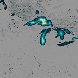
The GLObal Bathymetric (GLOBathy) dataset, comprising data on over 1.4 million waterbodies globally, has been meticulously developed to harmonize with the widely recognized HydroLAKES dataset. Utilizing a sophisticated Geographic Information System (GIS)-based framework, GLOBathy constructs detailed bathymetric maps by integrating maximum depth estimates and geometric/geophysical … bathymetry community-dataset hydrology sat-io surface-ground-water -
LandScan Population Data Global 1km
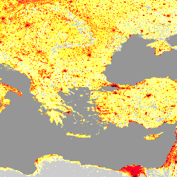
The LandScan dataset, provided by the Oak Ridge National Laboratory (ORNL), offers a comprehensive and high-resolution global population distribution dataset that serves as a valuable resource for a wide range of applications. Leveraging state-of-the-art spatial modeling techniques and advanced geospatial data sources, LandScan provides detailed … community-dataset demography landscan population sat-io -
United States Drought Monitor
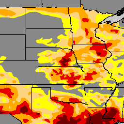
The U.S. Drought Monitor is a map released every Thursday, showing parts of the U.S. that are in drought. The map uses five classifications: abnormally dry (D0), showing areas that may be going into or are coming out of drought, and four levels of drought: … community-dataset drought noaa precipitation sat-io usda