Page Summary
-
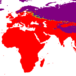
This dataset, part of the Malaria Atlas Project Catalog, provides gap-filled annual nighttime Land Surface Temperature (LST) derived from MODIS MOD11A2 v6.1 products at a 1km resolution.
-
The data, available from 2001 to 2024, is gap-filled using the Weiss et al (2014) method to account for missing data due to cloud cover.
-
The dataset includes a
Meanband representing the average nighttime LST for each pixel, with values ranging from approximately -74°C to 63.87°C. -
Usage of this dataset is governed by the CC-BY-NC-SA-4.0 terms of use.
- Catalog Owner
- The Malaria Atlas Project
- Dataset Availability
- 2001-03-01T00:00:00Z–2024-01-01T00:00:00Z
- Dataset Producer
- The Malaria Atlas Project
- Contact
- The Malaria Atlas Project
- Cadence
- 1 Year
- Tags
Description
Nighttime Land Surface Temperature (LST) are derived from the ~1km MODIS MOD11A2 v6.1 products. The 8-daily composites are converted to degrees Celsius and then gap-filled using the approach outlined in Weiss et al (2014) to eliminate missing data caused by factors such as cloud cover. After gap-filling the data was clipped to thresholds of [-100, 100] to ensure valid values.
The gap-filled 8-daily ~1km outputs are then aggregated temporally to produce monthly and annual products.
Bands
Bands
Pixel size: 5000 meters (all bands)
| Name | Min | Max | Pixel Size | Description |
|---|---|---|---|---|
Mean |
-74.03* | 63.87* | 5000 meters | The mean value of nighttime land surface temperature for each aggregated pixel. |
Terms of Use
Terms of Use
Citations
Weiss, D.J., P.M. Atkinson, S. Bhatt, B. Mappin, S.I. Hay & P.W. Gething (2014) An effective approach for gap-filling continental scale remotely sensed time-series. ISPRS Journal of Photogrammetry and Remote Sensing, 98, 106-118. doi:10.1016/j.isprsjprs.2014.10.001
Explore with Earth Engine
Code Editor (JavaScript)
var dataset = ee.ImageCollection('projects/malariaatlasproject/assets/LST_Night_v061/1km/Annual')
                  .filter(ee.Filter.date('2018-01-01', '2023-01-01'));
var means = dataset.select('Mean');
var visParams = {
  min: -20.0,
  max: 50.0,
  palette: ['800080','0000ab','0000ff','008000','19ff2b','a8f7ff','ffff00','d6d600','ffa500','ff6b01','ff0000'],
};
Map.setCenter(0, 0, 2);
Map.addLayer(means, visParams, 'Annual LST Night: Malaria Atlas Project Gap-Filled Nighttime Land Surface Temperature');