Tetap teratur dengan koleksi
Simpan dan kategorikan konten berdasarkan preferensi Anda.
Maps Static API dapat menampilkan error atau peringatan saat terjadi
kesalahan. Panduan ini menjelaskan setiap pesan {i>error<i}, dan memberikan lebih
petunjuk untuk mengatasi error.
Permintaan tidak valid
Jika permintaan tidak valid, Maps Static API akan menampilkan
kode status HTTP 4xx dan pesan yang menjelaskan
masalah. Di bawah ini adalah contoh dari kondisi kesalahan tersebut. Catatan: Ini bukanlah
daftar lengkap kemungkinan kesalahan. Periksa kode error dan pesan yang sebenarnya yang ditampilkan oleh API untuk mengetahui detail masalah tertentu.
Contoh kondisi kesalahan
Kode status
Permintaan berisi parameter yang tidak valid, atau parameter yang diperlukan tidak ada. Misalnya, parameter size tidak berada dalam
rentang nilai numerik yang diharapkan, atau hilang dari permintaan.
400 BAD REQUEST
Kunci API yang disertakan dalam permintaan tidak valid.
403 FORBIDDEN
Kesalahan yang mencegah peta ditampilkan
Jika permintaan valid, tetapi terjadi error lain yang mencegah peta ditampilkan, Maps Static API akan menampilkan teks atau gambar error, bukan peta, bergantung pada error-nya. Contoh kondisi error tersebut adalah saat aplikasi melebihi batas penggunaan.
Gambar: Gambar error ditampilkan, bukan peta
Error terkait kunci API dan penagihan
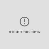
Jika Anda menggunakan Maps Static API tanpa kunci API, atau jika penagihan
tidak diaktifkan di akun Anda, halaman akan menampilkan gambar error, bukan
map, dengan tautan yang menunjukkan jenis kesalahan. Misalnya,
"g.co/staticmaperror/key".
Error dan solusi kunci
Anda menggunakan Maps Static API tanpa kunci API. Untuk
mengatasinya, Anda harus:
Permintaan Anda tidak memiliki tanda tangan digital (wajib). Untuk mengatasi,
Tanda tangani URL Anda
Peringatan
Untuk beberapa kondisi error, API menampilkan peta, tetapi beberapa informasi
hilang dari peta. Ketika ini terjadi, dua kondisi terjadi
untuk memberi tahu Anda tentang
peringatan tersebut.
Satu, peta ditampilkan, namun dengan bilah error kuning yang tumpang-tindih
di bagian atas peta dengan teks "Map error: g.co/staticmaperror".
Kedua, API akan menampilkan peringatan dalam bentuk header HTTP yang bernama X-Staticmap-API-Warning.
Misalnya, URL berikut berisi nilai yang tidak terduga dalam
Parameter markers:
Terjadi kesalahan saat mencoba untuk melakukan geocode permintaan. Ada banyak varian pesan ini, bergantung pada elemen tempat geocoding gagal (pusat, penanda, terlihat, atau jalur) dan jumlah elemen yang gagal. Salah satu contoh peringatan ini adalah
X-Staticmap-API-Warning:Error geocoding: marker 1, sebagai
yang ditunjukkan dalam contoh di atas.
Too many geocoded markers requested (max is 15).
Permintaan menetapkan penanda melebihi jumlah maksimum yang diizinkan
dengan alamat yang dapat dibaca manusia. Maksimumnya 15. Perhatikan bahwa batas ini hanya berlaku untuk penanda yang ditetapkan sebagai alamat yang dapat dibaca manusia dan memerlukan geocoding. Ini tidak berlaku untuk penanda yang ditentukan dengan koordinat lintang/bujur.
Too many geocoded polyline vertices requested (max is 15).
Permintaan menetapkan jumlah polyline maksimum yang diizinkan
dengan alamat yang dapat dibaca manusia. Maksimumnya 15. Perhatikan bahwa batas ini
hanya berlaku untuk polyline dengan verteks yang ditetapkan
sebagai alamat yang dapat dibaca manusia,
memerlukan geocoding. Ini tidak berlaku untuk polyline yang ditetapkan dengan
koordinat lintang/bujur.
[[["Mudah dipahami","easyToUnderstand","thumb-up"],["Memecahkan masalah saya","solvedMyProblem","thumb-up"],["Lainnya","otherUp","thumb-up"]],[["Informasi yang saya butuhkan tidak ada","missingTheInformationINeed","thumb-down"],["Terlalu rumit/langkahnya terlalu banyak","tooComplicatedTooManySteps","thumb-down"],["Sudah usang","outOfDate","thumb-down"],["Masalah terjemahan","translationIssue","thumb-down"],["Masalah kode / contoh","samplesCodeIssue","thumb-down"],["Lainnya","otherDown","thumb-down"]],["Terakhir diperbarui pada 2025-09-04 UTC."],[[["\u003cp\u003eThe Maps Static API returns errors as HTTP status codes or warning messages for invalid requests, usage limits, or issues with API keys and billing.\u003c/p\u003e\n"],["\u003cp\u003eErrors that prevent map display can result in error images or text messages instead of the map, with details provided in the response.\u003c/p\u003e\n"],["\u003cp\u003eWarnings about potential issues, like geocoding problems or marker limits, are indicated by a yellow error bar on the map and HTTP header warnings.\u003c/p\u003e\n"],["\u003cp\u003eFor invalid requests, refer to the HTTP status code (e.g., 400, 403) and message for details about the specific issue.\u003c/p\u003e\n"],["\u003cp\u003eAlways check for HTTP header warnings and the yellow error bar to ensure your map is displayed correctly and address potential issues.\u003c/p\u003e\n"]]],[],null,["# Error Messages in Maps Static API\n\nThe Maps Static API may issue an error or warning when something goes\nwrong. This guide explains each error message, and provides further\ninstructions for resolving errors.\n\nInvalid requests\n----------------\n\nIn the case of an invalid request, the Maps Static API returns\nan HTTP `4xx` status code and a message describing the\nproblem. Below are examples of such error conditions. Note: This is not\na complete list of the possible errors. Please check the actual error code\nand message returned by the API for details of specific problems.\n\n| Example of error condition | Status code |\n|------------------------------------------------------------------------------------------------------------------------------------------------------------------------------------------------------|-------------------|\n| The request includes an invalid parameter, or a required parameter is missing. For example, the `size` parameter is not within the expected range of numeric values, or is missing from the request. | `400 BAD REQUEST` |\n| The API key included in the request is invalid. | `403 FORBIDDEN` |\n\nErrors that prevent a map from being displayed\n----------------------------------------------\n\nIf the request is valid, but another error occurs that prevents the map from\nbeing displayed, the Maps Static API returns either text or an error\nimage instead of the map, depending on the error. An example of such an error\ncondition is when the application exceeds its\n[usage limits](/maps/documentation/maps-static/usage-limits).\n\nFigure: An error image displayed instead of a map\n\n### Errors related to API keys and billing\n\nIf you use the Maps Static API without an API key, or if billing\nis not enabled on your account, the page displays an error image instead of a\nmap, with a link indicating the type of error. For example\n\"g.co/staticmaperror/key\".\n\n| Keyless errors and solutions ||\n|---|-----------------------------------------------------------------------------------------------------------------------------------------------------------------------------------------------------------------------------------------------------------------------------------------------------------------------------------------------------------|\n| | You are using the Maps Static API without an API key. To resolve, you must: 1. [Get an API key](/maps/documentation/maps-static/get-api-key#get-an-api-key) 2. [Enable billing](https://console.cloud.google.com/project/_/billing/enable?utm_source=Docs_BillingNudge) 3. [Sign your URL](/maps/documentation/maps-static/get-api-key#digital-signature) |\n| | Your request is missing a digital signature (required). To resolve, [Sign your URL](/maps/documentation/maps-static/get-api-key#digital-signature) |\n\nWarnings\n--------\n\nFor some error conditions, the API returns a map but some information may\nbe missing from the map. When this happens, two conditions occur to inform you of\nthe warning.\n\n- One, the map displays, but with a yellow error bar superimposed over top of the map with the text \"Map error: g.co/staticmaperror\".\n- Two, the API returns a warning in the form of an HTTP header named `X-Staticmap-API-Warning`.\n\nFor example, the following URL contains an unexpected value in the\n`markers` parameter: \n\n```\nhttps://maps.googleapis.com/maps/api/staticmap?center=Williamsburg,Brooklyn,NY&zoom=13&scale=1&size=400x400&markers=sdgaags&key=YOUR_API_KEY\n```\n\nThe API returns a map, but displays a yellow error bar superimposed\nover the image with \"Map error: g.co/staticmaperror\":\n\nThe API also returns the following HTTP header: \n\n```\nX-Staticmap-API-Warning:Error geocoding: marker 1\n```\n\nThe following table describes the warnings that the API may issue as HTTP\nheaders:\n\n| Warnings in `X-Staticmap-API-Warning` headers ||\n|-------------------------------------------------------------------------------|---------------------------------------------------------------------------------------------------------------------------------------------------------------------------------------------------------------------------------------------------------------------------------------------------------------------------------------------------|\n| `Error geocoding: [center, ][marker #number, ][visible #num, ][path #num, ]*` | An error occurred while attempting to geocode the request. There are many variants of this message, depending on the element where geocoding failed (center, marker, visible, or path) and the number of elements that failed. One example of this warning is `X-Staticmap-API-Warning:Error geocoding: marker 1`, as shown in the above example. |\n| `Too many geocoded markers requested (max is 15).` | The request specifies more than the allowed maximum number of markers with a human readable address. The maximum is 15. Note that this limit applies only to markers specified as a human-readable address that requires geocoding. It does not apply to markers specified with latitude/longitude coordinates. |\n| `Too many geocoded polyline vertices requested (max is 15).` | The request specifies more than the allowed maximum number of polylines with a human readable address. The maximum is 15. Note that this limit applies only to polylines with vertices specified as human-readable addresses that require geocoding. It does not apply to polylines specified with latitude/longitude coordinates. |\n\nYou can see the HTTP header warnings in the\n[Chrome DevTools Console](/web/tools/chrome-devtools/console/console-write#errors_and_warnings), the\n[Firefox\nWeb Console](https://developer.mozilla.org/en-US/docs/Tools/Web_Console), or other equivalent tools in your browser.\n| **Note:** You should check for HTTP header warnings if you notice the yellow error bar on the map indicating that something may be missing from the map. It's also a good idea to check for warnings before launching a new application. Consider also whether user input or internationalization could lead to unexpected characters or malformed latitude/longitude coordinate specifications in the request."]]