קל לארגן דפים בעזרת אוספים
אפשר לשמור ולסווג תוכן על סמך ההעדפות שלך.
אם משהו משתבש, יכול להיות שתופיע שגיאה או אזהרה ב-Maps Static API. במדריך הזה מוסבר מה המשמעות של כל הודעת שגיאה, ומפורטות הוראות נוספות לפתרון השגיאות.
בקשות לא חוקיות
במקרה של בקשה לא חוקית, ה-Maps Static API מחזיר קוד סטטוס HTTP 4xx והודעה שמתארת את הבעיה. בהמשך מפורטות דוגמאות לתנאי שגיאה כאלה. הערה: המקור הזה הוא לא
רשימה מלאה של השגיאות האפשריות. כדי לקבל פרטים על בעיות ספציפיות, צריך לבדוק את קוד השגיאה ואת ההודעה בפועל שמוחזרים על ידי ה-API.
דוגמה למצב שגיאה
קוד סטטוס
הבקשה כוללת פרמטר לא חוקי, או שפרמטר נדרש
חסר. לדוגמה, הפרמטר size לא נמצא בטווח הצפוי של ערכים מספריים, או שהוא חסר בבקשה.
400 BAD REQUEST
מפתח ה-API שנכלל בבקשה לא תקין.
403 FORBIDDEN
שגיאות שמונעות את הצגת המפה
אם הבקשה תקינה, אבל מתרחשת שגיאה אחרת שמונעת את הצגת המפה, ה-API הסטטי של מפות Google מחזיר טקסט או תמונה של שגיאה במקום המפה, בהתאם לשגיאה. דוגמה לשגיאה כזו
התנאי הוא כשהאפליקציה חורגת מ
מגבלות שימוש.
איור: תמונת שגיאה שמוצגת במקום מפה
שגיאות שקשורות למפתחות API ולחיוב
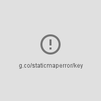
אם משתמשים ב-Maps Static API ללא מפתח API, או אם החיוב לא מופעל בחשבון, בדף יוצג תמונת שגיאה במקום מפה, עם קישור שמציין את סוג השגיאה. לדוגמה
'g.co/staticmaperror/key'.
שגיאות ופתרונות ללא מפתח
השתמשת ב-API הסטטי של מפות Google ללא מפתח API. כדי לפתור את הבעיה:
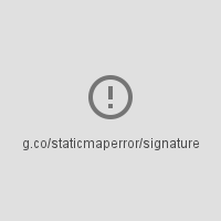
אירעה שגיאה במהלך הניסיון לבצע קידוד גיאוגרפי של הבקשה. יש
הרבה וריאציות של ההודעה, בהתאם לרכיב שבו אפשר לבצע קידוד גיאוגרפי
נכשל (מרכז, סמן, גלוי או נתיב) ומספר הרכיבים
שנכשל. דוגמה לאזהרה הזו היא הערך X-Staticmap-API-Warning:Error geocoding: marker 1, כפי שמוצג בדוגמה שלמעלה.
Too many geocoded markers requested (max is 15).
הבקשה מציינת יותר מהמספר המקסימלי המותר של סמנים
עם כתובת שבודק אנושי יכול לקרוא. המספר המקסימלי הוא 15. שימו לב שהמגבלה הזו
חלה רק על סמנים שצוינו ככתובת קריאה לאנשים
דורש קידוד גיאוגרפי. הוא לא חל על סמנים שצוינו באמצעות קואורדינטות של קו אורך וקו רוחב.
Too many geocoded polyline vertices requested (max is 15).
הבקשה כוללת יותר מהמספר המקסימלי המותר של קווים פוליגונליים עם כתובת שניתנת לקריאה על ידי בני אדם. המספר המקסימלי הוא 15. חשוב לציין שהמגבלה הזו חלה רק על קווים פוליגונליים עם קודקודים שצוינו ככתובות שניתנות לקריאה על ידי בני אדם, שדורשות גיאוקודינג. הוא לא חל על קווים פוליגונליים שצוינו באמצעות קואורדינטות של קו אורך וקו רוחב.
[[["התוכן קל להבנה","easyToUnderstand","thumb-up"],["התוכן עזר לי לפתור בעיה","solvedMyProblem","thumb-up"],["סיבה אחרת","otherUp","thumb-up"]],[["חסרים לי מידע או פרטים","missingTheInformationINeed","thumb-down"],["התוכן מורכב מדי או עם יותר מדי שלבים","tooComplicatedTooManySteps","thumb-down"],["התוכן לא עדכני","outOfDate","thumb-down"],["בעיה בתרגום","translationIssue","thumb-down"],["בעיה בדוגמאות/בקוד","samplesCodeIssue","thumb-down"],["סיבה אחרת","otherDown","thumb-down"]],["עדכון אחרון: 2025-09-04 (שעון UTC)."],[[["\u003cp\u003eThe Maps Static API returns errors as HTTP status codes or warning messages for invalid requests, usage limits, or issues with API keys and billing.\u003c/p\u003e\n"],["\u003cp\u003eErrors that prevent map display can result in error images or text messages instead of the map, with details provided in the response.\u003c/p\u003e\n"],["\u003cp\u003eWarnings about potential issues, like geocoding problems or marker limits, are indicated by a yellow error bar on the map and HTTP header warnings.\u003c/p\u003e\n"],["\u003cp\u003eFor invalid requests, refer to the HTTP status code (e.g., 400, 403) and message for details about the specific issue.\u003c/p\u003e\n"],["\u003cp\u003eAlways check for HTTP header warnings and the yellow error bar to ensure your map is displayed correctly and address potential issues.\u003c/p\u003e\n"]]],[],null,["# Error Messages in Maps Static API\n\nThe Maps Static API may issue an error or warning when something goes\nwrong. This guide explains each error message, and provides further\ninstructions for resolving errors.\n\nInvalid requests\n----------------\n\nIn the case of an invalid request, the Maps Static API returns\nan HTTP `4xx` status code and a message describing the\nproblem. Below are examples of such error conditions. Note: This is not\na complete list of the possible errors. Please check the actual error code\nand message returned by the API for details of specific problems.\n\n| Example of error condition | Status code |\n|------------------------------------------------------------------------------------------------------------------------------------------------------------------------------------------------------|-------------------|\n| The request includes an invalid parameter, or a required parameter is missing. For example, the `size` parameter is not within the expected range of numeric values, or is missing from the request. | `400 BAD REQUEST` |\n| The API key included in the request is invalid. | `403 FORBIDDEN` |\n\nErrors that prevent a map from being displayed\n----------------------------------------------\n\nIf the request is valid, but another error occurs that prevents the map from\nbeing displayed, the Maps Static API returns either text or an error\nimage instead of the map, depending on the error. An example of such an error\ncondition is when the application exceeds its\n[usage limits](/maps/documentation/maps-static/usage-limits).\n\nFigure: An error image displayed instead of a map\n\n### Errors related to API keys and billing\n\nIf you use the Maps Static API without an API key, or if billing\nis not enabled on your account, the page displays an error image instead of a\nmap, with a link indicating the type of error. For example\n\"g.co/staticmaperror/key\".\n\n| Keyless errors and solutions ||\n|---|-----------------------------------------------------------------------------------------------------------------------------------------------------------------------------------------------------------------------------------------------------------------------------------------------------------------------------------------------------------|\n| | You are using the Maps Static API without an API key. To resolve, you must: 1. [Get an API key](/maps/documentation/maps-static/get-api-key#get-an-api-key) 2. [Enable billing](https://console.cloud.google.com/project/_/billing/enable?utm_source=Docs_BillingNudge) 3. [Sign your URL](/maps/documentation/maps-static/get-api-key#digital-signature) |\n| | Your request is missing a digital signature (required). To resolve, [Sign your URL](/maps/documentation/maps-static/get-api-key#digital-signature) |\n\nWarnings\n--------\n\nFor some error conditions, the API returns a map but some information may\nbe missing from the map. When this happens, two conditions occur to inform you of\nthe warning.\n\n- One, the map displays, but with a yellow error bar superimposed over top of the map with the text \"Map error: g.co/staticmaperror\".\n- Two, the API returns a warning in the form of an HTTP header named `X-Staticmap-API-Warning`.\n\nFor example, the following URL contains an unexpected value in the\n`markers` parameter: \n\n```\nhttps://maps.googleapis.com/maps/api/staticmap?center=Williamsburg,Brooklyn,NY&zoom=13&scale=1&size=400x400&markers=sdgaags&key=YOUR_API_KEY\n```\n\nThe API returns a map, but displays a yellow error bar superimposed\nover the image with \"Map error: g.co/staticmaperror\":\n\nThe API also returns the following HTTP header: \n\n```\nX-Staticmap-API-Warning:Error geocoding: marker 1\n```\n\nThe following table describes the warnings that the API may issue as HTTP\nheaders:\n\n| Warnings in `X-Staticmap-API-Warning` headers ||\n|-------------------------------------------------------------------------------|---------------------------------------------------------------------------------------------------------------------------------------------------------------------------------------------------------------------------------------------------------------------------------------------------------------------------------------------------|\n| `Error geocoding: [center, ][marker #number, ][visible #num, ][path #num, ]*` | An error occurred while attempting to geocode the request. There are many variants of this message, depending on the element where geocoding failed (center, marker, visible, or path) and the number of elements that failed. One example of this warning is `X-Staticmap-API-Warning:Error geocoding: marker 1`, as shown in the above example. |\n| `Too many geocoded markers requested (max is 15).` | The request specifies more than the allowed maximum number of markers with a human readable address. The maximum is 15. Note that this limit applies only to markers specified as a human-readable address that requires geocoding. It does not apply to markers specified with latitude/longitude coordinates. |\n| `Too many geocoded polyline vertices requested (max is 15).` | The request specifies more than the allowed maximum number of polylines with a human readable address. The maximum is 15. Note that this limit applies only to polylines with vertices specified as human-readable addresses that require geocoding. It does not apply to polylines specified with latitude/longitude coordinates. |\n\nYou can see the HTTP header warnings in the\n[Chrome DevTools Console](/web/tools/chrome-devtools/console/console-write#errors_and_warnings), the\n[Firefox\nWeb Console](https://developer.mozilla.org/en-US/docs/Tools/Web_Console), or other equivalent tools in your browser.\n| **Note:** You should check for HTTP header warnings if you notice the yellow error bar on the map indicating that something may be missing from the map. It's also a good idea to check for warnings before launching a new application. Consider also whether user input or internationalization could lead to unexpected characters or malformed latitude/longitude coordinate specifications in the request."]]