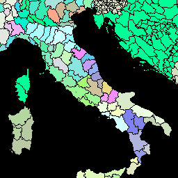
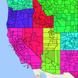
[[["わかりやすい","easyToUnderstand","thumb-up"],["問題の解決に役立った","solvedMyProblem","thumb-up"],["その他","otherUp","thumb-up"]],[["必要な情報がない","missingTheInformationINeed","thumb-down"],["複雑すぎる / 手順が多すぎる","tooComplicatedTooManySteps","thumb-down"],["最新ではない","outOfDate","thumb-down"],["翻訳に関する問題","translationIssue","thumb-down"],["サンプル / コードに問題がある","samplesCodeIssue","thumb-down"],["その他","otherDown","thumb-down"]],[],[],["The provided data includes administrative unit datasets. The Global Administrative Unit Layers (GAUL) compile information on administrative units globally, standardizing spatial data. There are two versions, one simplified at 500m. The US Census Bureau TIGER dataset offers boundaries for primary legal divisions of US states, called counties, parishes in Louisiana, and boroughs in Alaska, for 2016 and 2018. All datasets are accessible as tables and contain relevant tags for specific search terms.\n"]]