Page Summary
-
The HydroSHEDS mapping product provides consistent hydrographic information for regional and global applications.
-
This dataset is a hydrologically conditioned elevation model based on SRTM data from 2000.
-
The dataset has a resolution of 3 arc-seconds and includes hydrologically conditioned DEM and drainage direction data.
-
HydroSHEDS data is free for both non-commercial and commercial use.
- Dataset Availability
- 2000-02-11T00:00:00Z–2000-02-22T00:00:00Z
- Dataset Producer
- WWF
- Tags
Description
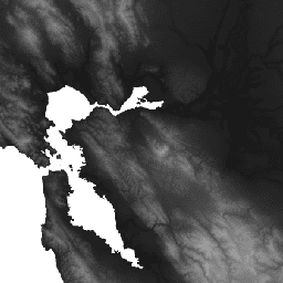
HydroSHEDS is a mapping product that provides hydrographic information for regional and global-scale applications in a consistent format. It offers a suite of geo-referenced datasets (vector and raster) at various scales, including river networks, watershed boundaries, drainage directions, and flow accumulations. HydroSHEDS is based on elevation data obtained in 2000 by NASA's Shuttle Radar Topography Mission (SRTM).
This hydrologically conditioned elevation dataset is the result of an iterative conditioning and correction process. Note that the conditioning process alters the original DEM and may render it incorrect for applications other than deriving drainage directions. Endorheic basins (inland sinks) are ''seeded'' with a no-data cell at their lowest point in order to terminate the flow. Full details of the underlying digital elevation model are available in the HydroSHEDS website and documentation.
This dataset is at 3 arc-second resolution. The datasets available at 3 arc-seconds are the Void-Filled DEM, Hydrologically Conditioned DEM, and Drainage (Flow) Direction.
There are two areas with incorrect negative values of -100 close to Vancouver, Canada around (50.16, -123.85) and Australia (-14.96, 129.62)
Bands
Bands
Pixel size: 92.77 meters (all bands)
| Name | Units | Min | Max | Pixel Size | Description |
|---|---|---|---|---|---|
b1 |
m | -440* | 8527* | 92.77 meters | Elevation |
Terms of Use
Terms of Use
HydroSHEDS data are free for non-commercial and commercial use. For more information, please refer to the License Agreement.
Citations
Lehner, B., Verdin, K., Jarvis, A. (2008): New global hydrography derived from spaceborne elevation data. Eos, Transactions, AGU, 89(10): 93-94.
Explore with Earth Engine
Code Editor (JavaScript)
var dataset = ee.Image('WWF/HydroSHEDS/03CONDEM');
var elevation = dataset.select('b1');
var elevationVis = {
  min: -50.0,
  max: 3000.0,
  gamma: 2.0,
};
Map.setCenter(-121.652, 38.022, 8);
Map.addLayer(elevation, elevationVis, 'Elevation');