Page Summary
-
The dataset covers evapotranspiration (ET) from 1999 to 2024 and is provided by OpenET, Inc.
-
It uses the SIMS model, which incorporates a gridded soil water balance model to account for soil evaporation and is primarily focused on croplands.
-
The data is provided monthly and has a pixel size of 30 meters.
-
The dataset includes bands for
et(SIMS ET value in mm) andcount(number of cloud free values). -
The terms of use are CC-BY-4.0.
- Dataset Availability
- 1999-10-01T00:00:00Z–2024-12-01T00:00:00Z
- Dataset Producer
- OpenET, Inc.
- Cadence
- 1 Month
- Tags
Description
Satellite Irrigation Management Support
The NASA Satellite Irrigation Management Support (SIMS) model was originally developed to support satellite mapping of crop coefficients and evapotranspiration (ET) from irrigated lands and to increase access to this data to support use in irrigation scheduling and regional assessment of agricultural water needs (Melton et al., 2012). SIMS uses a reflectance based approach and incorporates the density coefficient described by Allen and Pereira (2009) and Pereira et al. (2020) to compute basal crop coefficients for each 30 x 30 m pixel. The primary change from the most recent SIMS publication (Pereira et al., 2020) for implementation in OpenET is the integration of a gridded soil water balance model to account for soil evaporation following precipitation events. Results of the OpenET Phase I intercomparison and accuracy assessment (Melton et al., 2022) showed that SIMS generally performed well for cropland sites during the growing season, but had a persistent low bias during the winter months or other time periods with frequent precipitation. This result was anticipated, since the reflectance-based approach used by SIMS is not sensitive to soil evaporation. To correct for this underestimation, a soil water balance model based on FAO-56 (Allen et al., 1998) was implemented on Google Earth Engine and driven with gridded precipitation data from gridMET to estimate soil evaporation coefficients. These coefficients were then combined with the basal crop coefficients calculated by SIMS to calculate total crop evapotranspiration using the dual crop coefficient approach. In addition, a modest positive bias was observed in the SIMS data for periods with low or sparse vegetative cover. To correct for this bias, updates were made to the equations that calculate the minimum basal crop coefficient to allow lower minimum basal crop coefficient values to be achieved. Full documentation of the SIMS model, current algorithms, and details and equations used in the soil water balance model are included in the SIMS user manual.
The SIMS model calculates ET under well-watered conditions for the current crop growth stage and condition as measured by the satellite data, and SIMS is generally expected to have a positive bias for deficit irrigated crops and croplands with short-term or intermittent crop water stress. At present, SIMS is only implemented for croplands, and non-agricultural lands are masked out in this data collection. Future research will extend the vegetation density-crop coefficient approach used within SIMS to other land cover types. Additional information
Bands
Pixel Size
30 meters
Bands
| Name | Units | Pixel Size | Description |
|---|---|---|---|
et |
mm | meters | SIMS ET value |
count |
count | meters | Number of cloud free values |
Image Properties
Image Properties
| Name | Type | Description |
|---|---|---|
| build_date | STRING | Date assets were built |
| cloud_cover_max | DOUBLE | Maximum CLOUD_COVER_LAND percent value for Landsat images included in interpolation |
| collections | STRING | List of Landsat collections for Landsat images included in the interpolation |
| core_version | STRING | OpenET core library version |
| end_date | STRING | End date of month |
| et_reference_band | STRING | Band in et_reference_source that contains the daily reference ET data |
| et_reference_resample | STRING | Spatial interpolation mode to resample daily reference ET data |
| et_reference_source | STRING | Collection ID for the daily reference ET data |
| interp_days | DOUBLE | Maximum number of days before and after each image date to include in interpolation |
| interp_method | STRING | Method used to interpolate between Landsat model estimates |
| interp_source_count | DOUBLE | Number of available images in the interpolation source image collection for the target month |
| mgrs_tile | STRING | MGRS grid zone ID |
| model_name | STRING | OpenET model name |
| model_version | STRING | OpenET model version |
| scale_factor_count | DOUBLE | Scaling factor that should be applied to the count band |
| scale_factor_et | DOUBLE | Scaling factor that should be applied to the et band |
| start_date | STRING | Start date of month |
Terms of Use
Terms of Use
Citations
Melton, F., Huntington, J., Grimm, R., Herring, J., Hall, M., Rollison, D., Erickson, T., Allen, R., Anderson, M., Fisher, J., Kilic, A., Senay, G., volk, J., Hain, C., Johnson, L., Ruhoff, A., Blanenau, P., Bromley, M., Carrara, W., Daudert, B., Doherty, C., Dunkerly, C., Friedrichs, M., Guzman, A., Halverson, G., Hansen, J., Harding, J., Kang, Y., Ketchum, D., Minor, B., Morton, C., Revelle, P., Ortega-Salazar, S., Ott, T., Ozdogon, M., Schull, M., Wang, T., Yang, Y., Anderson, R., 2021. "OpenET: Filling a Critical Data Gap in Water Management for the Western United States. "Journal of the American Water Resources Association, 58(6), pp.971-994. doi:10.1111/1752-1688.12956
Pereira, L.S., P. Paredes, F.S. Melton, L.F. Johnson, R. López-Urrea, J. Cancela, and R.G. Allen. 2020. "Prediction of Basal Crop Coefficients from Fraction of Ground Cover and Height." Agricultural Water Management, Special Issue on Updates to the FAO56 Crop Water Requirements Method 241, 106197. doi:10.1016/j.agwat.2020.106197
Melton, F.S., L.F. Johnson, C.P. Lund, L.L. Pierce, A.R. Michaelis, S.H. Hiatt, A. Guzman et al. 2012. "Satellite Irrigation Management Support with the Terrestrial Observation and Prediction System: A Framework for Integration of Satellite and Surface Observations to Support Improvements in Agricultural Water Resource Management.IEEE Journal of Selected Topics in Applied Earth Observations and Remote Sensing 5 (6): 1709–21. doi:10.1109/JSTARS.2012.2214474
Allen, R.G. and Pereira, L.S., 2009. Estimating crop coefficients from fraction of ground cover and height. Irrigation Science, 28, pp.17-34. doi:10.1007/s00271-009-0182-z
Allen, R.G., Pereira, L.S., Raes, D. and Smith, M., 1998. Crop evapotranspiration-Guidelines for computing crop water requirements-FAO Irrigation and drainage paper 56. Fao, Rome, 300 (9), p.D05109. https://www.fao.org/3/x0490e/x0490e00.htm
DOIs
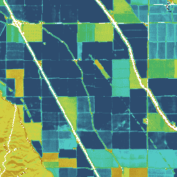
Explore with Earth Engine
Code Editor (JavaScript)
var dataset = ee.ImageCollection('OpenET/SIMS/CONUS/GRIDMET/MONTHLY/v2_0')
  .filterDate('2020-01-01', '2021-01-01');

// Compute the annual evapotranspiration (ET) as the sum of the monthly ET
// images for the year.
var et = dataset.select('et').sum();

var visualization = {
  min: 0,
  max: 1400,
  palette: [
    '9e6212', 'ac7d1d', 'ba9829', 'c8b434', 'd6cf40', 'bed44b', '9fcb51',
    '80c256', '61b95c', '42b062', '45b677', '49bc8d', '4dc2a2', '51c8b8',
    '55cece', '4db4ba', '459aa7', '3d8094', '356681', '2d4c6e',
  ]
};

Map.setCenter(-100, 38, 5);

Map.addLayer(et, visualization, 'OpenET SIMS Annual ET');