Page Summary
-
The Global Inland Water dataset identifies inland surface water bodies like lakes, rivers, and reservoirs from the GLS 2000 epoch.
-
In 2000, 3,650,723 km2 of inland water were identified globally, with North America and Asia containing about three quarters of this total.
-
Boreal forests and tundra hold the largest share of global inland water, approximately 40%.
-
This dataset demonstrates strong correlation with other high-resolution datasets but may have residual errors from seasonality, snow/ice, and clouds.
-
The dataset's intellectual property belongs to the University of Maryland and NASA, and usage is free with acknowledgement.

- Dataset Availability
- 2000-01-01T00:00:00Z–2000-12-31T00:00:00Z
- Dataset Producer
- NASA LP DAAC at the USGS EROS Center
- Tags
Description
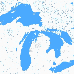
The Global Inland Water dataset shows inland surface water bodies, including fresh and saline lakes, rivers, and reservoirs.
From the GLS 2000 epoch, 3,650,723 km2 of inland water were identified, around three quarters of which were in North America and Asia. Boreal forests and tundra hold the largest portion of inland water, about 40% of the global total. The data exhibits strong linear correlation with both the MODIS dataset as well as 30-m resolution datasets over the United States and Canada. Residual errors were due primarily to the seasonality of water cover, snow and ice, and residual clouds.
The dataset contains one or more image for each available Landsat WRS2 path/row.
Documentation:
Bands
Pixel Size
30 meters
Bands
| Name | Pixel Size | Description |
|---|---|---|
water |
meters | Water classification |
water Class Table
| Value | Color | Description |
|---|---|---|
| 1 | #fafafa | Land |
| 2 | #00c5ff | Water |
| 4 | #df73ff | Snow/ice |
| 200 | #828282 | Cloud shadow |
| 201 | #cccccc | Cloud |
Image Properties
Image Properties
| Name | Type | Description |
|---|---|---|
| path | DOUBLE | Path |
| pathrow | STRING | Path and row |
| row | DOUBLE | Row |
| water_class_names | DOUBLE | Water class names |
| water_class_palette | DOUBLE | Water class palette |
| water_class_values | INT_LIST | Water class values |
Terms of Use
Terms of Use
Intellectual property rights to this dataset belong to University of Maryland, Department of Geographical Sciences and NASA. Usage is free if acklowedgement is made.
Citations
Data Citation: Global Inland Water, {Year, ...}, Global Land Cover Facility.
Paper/Methods Citation: Feng, Min, Joseph O. Sexton, Saurabh Channan, and John R. Townshend. 2015. A Global, High-Resolution (30-M) Inland Water Body Dataset for 2000: First Results of a Topographic-Spectral Classification Algorithm. International Journal of Digital Earth. doi:10.1080/17538947.2015.1026420.
DOIs
Explore with Earth Engine
Code Editor (JavaScript)
var dataset = ee.ImageCollection('GLCF/GLS_WATER');
var water = dataset.select('water');
var waterVis = {
  min: 1.0,
  max: 4.0,
  palette: ['fafafa', '00c5ff', 'df73ff', '828282', 'cccccc'],
};
Map.setCenter(-79.3094, 44.5693, 8);
Map.addLayer(water, waterVis, 'Water');