Page Summary
-
The RCMAP dataset provides percent cover of rangeland components in western North America from 1985-2023 using Landsat imagery.
-
The RCMAP product suite includes ten fractional components, such as annual herbaceous, bare ground, and sagebrush.
-
The collection includes RCMAP yearly products and trends for component timeseries.
-
RCMAP Rangeland Component Timeseries (1985-2023), v06
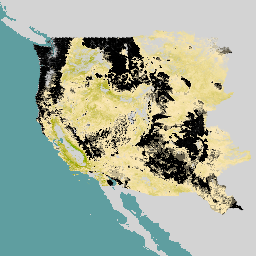
'The RCMAP (Rangeland Condition Monitoring Assessment and Projection) dataset quantifies the percent cover of rangeland components across western North America using Landsat imagery from 1985-2023. The RCMAP product suite consists of ten fractional components: annual herbaceous, bare ground, herbaceous, litter, non-sagebrush shrub, perennial herbaceous, sagebrush, … climate-change disturbance landsat-derived landuse-landcover nlcd rangeland -
RCMAP Rangeland Trends Year for Component Timeseries (1985-2023), v06
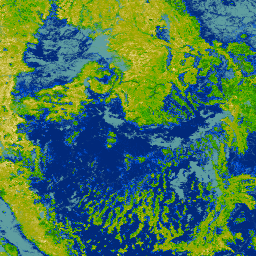
This collection includes RCMAP yearly products from 1985 through 2023. The RCMAP (Rangeland Condition Monitoring Assessment and Projection) dataset quantifies the percent cover of rangeland components across western North America using Landsat imagery from 1985-2023. The RCMAP product suite consists of ten fractional components: annual … climate-change disturbance landsat-derived landuse-landcover nlcd rangeland -
RCMAP Rangeland Trends for Component Timeseries (1985-2023), v06
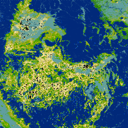
The RCMAP (Rangeland Condition Monitoring Assessment and Projection) dataset quantifies the percent cover of rangeland components across western North America using Landsat imagery from 1985-2023. The RCMAP product suite consists of ten fractional components: annual herbaceous, bare ground, herbaceous, litter, non-sagebrush shrub, perennial herbaceous, sagebrush, … climate-change disturbance landsat-derived landuse-landcover nlcd rangeland