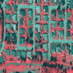
[[["わかりやすい","easyToUnderstand","thumb-up"],["問題の解決に役立った","solvedMyProblem","thumb-up"],["その他","otherUp","thumb-up"]],[["必要な情報がない","missingTheInformationINeed","thumb-down"],["複雑すぎる / 手順が多すぎる","tooComplicatedTooManySteps","thumb-down"],["最新ではない","outOfDate","thumb-down"],["翻訳に関する問題","translationIssue","thumb-down"],["サンプル / コードに問題がある","samplesCodeIssue","thumb-down"],["その他","otherDown","thumb-down"]],[],[[["\u003cp\u003eNLS Orthophotos are an aerial photo dataset covering all of Finland, provided by SMK (The Energy Agency).\u003c/p\u003e\n"],["\u003cp\u003eOrthophotos are created by combining several individual aerial photos, providing a geographically accurate representation.\u003c/p\u003e\n"],["\u003cp\u003eThe datasets are available in both RGB (Finland RGB NLS orthophotos 50 cm by SMK) and false color (Finland NRG NLS orthophotos 50 cm by SMK) formats.\u003c/p\u003e\n"],["\u003cp\u003eThese datasets offer high-resolution (50 cm) imagery for various applications.\u003c/p\u003e\n"]]],[],null,[]]