-
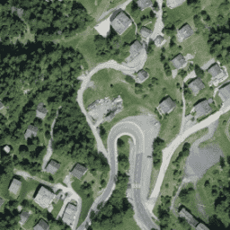
エストニアの RGB 低空飛行オルソフォト
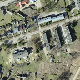
オルソ写真は、エストニアをカバーする航空写真データセットです。オルソフォトは、地形の起伏、撮影時の地面に対するカメラの傾き、カメラの中心投影によって生じた歪みが除去された、処理済みの航空写真です。デジタルオルソ画像には、… estonia low-flying orthophotos rgb -
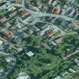
エストニアの RGB 正射画像
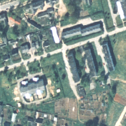
オルソ写真は、エストニアをカバーする航空写真データセットです。オルソフォトは、地形の起伏、撮影時の地面に対するカメラの傾き、カメラの中心投影によって生じた歪みが除去された、処理済みの航空写真です。デジタルオルソ画像には、… estonia orthophotos rgb -
SMK によるフィンランド RGB NLS オルソフォト 50 cm

NLS Orthophotos は、フィンランド全土をカバーする航空写真データセットです。このデータは SMK(エネルギー庁、以前は SMK と略称)から提供されています。オルソフォトは、複数の個々の航空写真を組み合わせたものです。オルソフォト形式の航空写真データセットは、… として利用できます。 finland orthophotos rgb smk -
ラトビアの RGB 正射画像
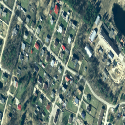
ラトビアでは、TKS-93 地図シート分割(1:10000 地図シートは 5 x 5 キロメートルに対応)に従って、ラトビアの座標系 LKS-92 TM でオルソフォト地図が作成されます。ラトビア全土のオルソフォト地図が … の縮尺で作成されています。 latvia orthophotos rgb -
NEON RGB カメラ画像

高解像度の赤、緑、青(RGB)の正射補正されたカメラ画像をモザイク処理し、最近傍再サンプリングを使用して固定された均一な空間グリッドに出力します。空間解像度は 0.1 m です。デジタル カメラは、NEON 空中観測プラットフォーム(AOP)の機器群の一部であり、… airborne forest highres neon neon-prod-earthengine orthophoto -
オランダのオルソフォト

オランダのオルソ写真は、カラー オルソ画像のセットです。全国の航空写真は、春に 7.5 cm の解像度で葉のない画像、夏に 25 cm の解像度で葉のある画像がそれぞれ 1 枚ずつ収集されます。詳細については、… をご覧ください。 netherlands orthophotos rgb -
Planet SkySat 公開オルソ画像、RGB
Planet labs Inc. の SkySat 衛星から取得されたこのデータは、2015 年に試験運用された「Skybox for Good ベータ版」プログラムのほか、さまざまなクライシス レスポンス イベントやその他のいくつかのプロジェクトのために収集されました。データは、5 バンドのマルチスペクトル/パン コレクションと、… highres pansharpened planet rgb satellite-imagery skysat -
SWISSIMAGE 10 cm RGB 画像
SWISSIMAGE 10 cm オルソフォト モザイクは、スイス全土の新しいカラー デジタル航空写真を組み合わせたもので、平野部とアルプスの主要な谷では 10 cm、アルプスでは 25 cm の地上解像度です。毎年更新されます。… orthophotos rgb -
スロバキアのオルソフォト
スロバキア共和国のオルソフォトモザイクは、重複、ギャップ、接続線に沿った明るさや色の違いが目立たない、一連のカラー オルソ画像です。詳細については、スロバキアのオルソフォトのドキュメントをご覧ください。 orthophotos rgb -
スペインの RGB 正射画像 10 cm
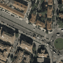
さまざまな行政機関が 2007 年から 2018 年にかけて実施したフライトのオルソフォトのモザイク。解像度は 10 cm ピクセル。このデータは、スペインの航空オルソフォトグラフィー国家計画(PNOA)から提供されています。詳細については、スペインのオルソフォトのドキュメントをご覧ください。 orthophotos rgb