Page Summary
-
MCD12Q2.006 and VNP22Q2 are data products providing global land surface phenology metrics yearly at 500m resolution.
-
Both MCD12Q2 Version 6.1 and VNP22Q2 data products are derived from time series using the two-band Enhanced Vegetation Index (EVI2).
-
MCD12Q2.006 Land Cover Dynamics Yearly Global 500m
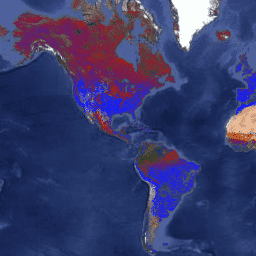
The Terra and Aqua combined Moderate Resolution Imaging Spectroradiometer (MODIS) Land Cover Dynamics (MCD12Q2) Version 6.1 data product provides global land surface phenology metrics at yearly intervals. The MCD12Q2 Version 6.1 data product is derived from time series of the 2-band Enhanced Vegetation Index (EVI2) … evi global landuse-landcover modis onset-greenness phenology -
VNP22Q2.002: Land Surface Phenology Yearly L3 Global 500m SIN Grid
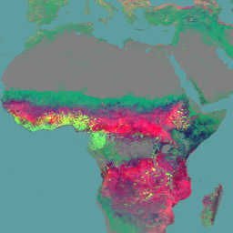
The Suomi National Polar-Orbiting Partnership (Suomi NPP) NASA Visible Infrared Imaging Radiometer Suite (VIIRS) Land Surface Phenology Yearly (VNP22Q2) Version 2 data product provides global land surface phenology (GLSP) metrics at yearly intervals. The VNP22Q2 data product is derived from time series of the two-band … land nasa ndvi noaa npp onset-greenness