-
Landsat 総一次生産量(米国本土)

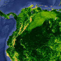
Landsat Gross Primary Production(GPP)CONUS データセットは、CONUS の Landsat 地表反射率を使用して GPP を推定します。総一次生産量(GPP)は、生態系の植物が吸収する炭素の量であり、純一次生産量(NPP)の計算に不可欠な要素です。GPP は、… を使用して計算されます。 16 日間 conus gpp gridmet-derived landsat mod17 -
MOD13A1.061 Terra グローバル植生指標(16 日間、500 m)
MOD13A1 V6.1 プロダクトは、ピクセル単位で植生指数(VI)値を提供します。植生レイヤは主に 2 つあります。1 つ目は、正規化植生指数(NDVI)です。これは、既存の米国海洋大気庁(NOAA)の継続性指数と呼ばれます。 16-day evi global modis nasa ndvi -
MOD13A2.061 Terra グローバル植生指標(16 日間、1 km)

MOD13A2 V6.1 プロダクトは、正規化植生指数(NDVI)と拡張植生指数(EVI)の 2 つの植生指数(VI)を提供します。NDVI は、既存の米国海洋大気庁 - 高度超高分解能放射計(NOAA-AVHRR)から導出された NDVI の継続性指標と呼ばれます。… 16-day evi global modis nasa ndvi -
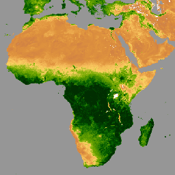
MOD13C1.061: Terra 植生指標 16 日間 L3 グローバル 0.05 度気候モデリング グリッド
Terra 中分解能撮像分光放射計(MODIS)植生指数 16 日間(MOD13C1)バージョン 6.1 プロダクトは、ピクセル単位で植生指数(VI)の値を提供します。植生レイヤは主に 2 つあります。1 つ目は NDVI(正規化植生指数)です。これは、… 16 日間 グローバル NASA Terra USGS 植生 -
MOD13Q1.061 Terra グローバル植生指標(16 日間、250 m)
MOD13Q1 V6.1 プロダクトは、ピクセル単位で植生指数(VI)の値を提供します。植生レイヤは主に 2 つあります。1 つ目は、正規化植生指数(NDVI)です。これは、既存の米国海洋大気庁(NOAA)の継続性指数と呼ばれます。 16-day evi global modis nasa ndvi -
MYD13A1.061 Aqua グローバル植生指標(16 日間、500 m)

MYD13A1 V6.1 プロダクトは、ピクセル単位で植生指数(VI)の値を提供します。植生レイヤは主に 2 つあります。1 つ目は、正規化植生指数(NDVI)です。これは、既存の米国海洋大気庁(NOAA)の継続性指数と呼ばれます。 16-day aqua evi global modis nasa -
MYD13A2.061 Aqua グローバル植生指標(16 日間、1 km)
MYD13A2 V6.1 プロダクトは、正規化植生指数(NDVI)と拡張植生指数(EVI)の 2 つの植生指数(VI)を提供します。NDVI は、既存の米国海洋大気庁 - 高度超高分解能放射計(NOAA-AVHRR)から導出された NDVI の継続性指標と呼ばれます。… 16-day aqua evi global modis nasa -
MYD13C1.061: Aqua 植生指標 16 日間 L3 グローバル 0.05 度 CMG
Aqua 中分解能撮像分光放射計(MODIS)植生指数 16 日間(MYD13C1)バージョン 6.1 プロダクトは、ピクセル単位で植生指数(VI)の値を提供します。植生レイヤは主に 2 つあります。1 つ目は NDVI(正規化植生指数)です。これは、… 16 日間 アクア グローバル NASA USGS 植生 -
MYD13Q1.061 Aqua グローバル植生指標(16 日間、250 m)

MYD13Q1 V6.1 プロダクトは、ピクセル単位で植生指数(VI)の値を提供します。植生レイヤは主に 2 つあります。1 つ目は、正規化植生指数(NDVI)です。これは、既存の米国海洋大気庁(NOAA)の継続性指数と呼ばれます。 16-day aqua evi global modis nasa -
VNP13A1.002: VIIRS 植生指数 16 日間 500 m

Suomi National Polar-Orbiting Partnership(S-NPP)NASA 可視赤外撮像機放射計(VIIRS)植生指数(VNP13A1)データ プロダクトは、500 メートルの解像度で 16 日間の取得期間に利用可能な最適なピクセルを選択するプロセスによって植生指数を提供します。VNP13 データ プロダクトは、… 16 日間 evi nasa ndvi noaa npp