Page Summary
-
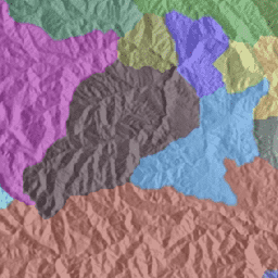
The HydroSHEDS dataset provides consistent hydrographic information for regional and global applications, including watershed boundaries.
-
This specific dataset includes polygons of nested, hierarchical watersheds at approximately 500m resolution, ranging from coarse to detailed levels.
-
The data is based on SRTM elevation data from 2000, with lower quality for regions above 60 degrees northern latitude due to lack of SRTM data.
-
HydroSHEDS data is free for both non-commercial and commercial use.
- Dataset Availability
- 2000-02-11T00:00:00Z–2000-02-22T00:00:00Z
- Dataset Producer
- WWF
- Tags
Description
HydroSHEDS is a mapping product that provides hydrographic information for regional and global-scale applications in a consistent format. It offers a suite of geo-referenced datasets (vector and raster) at various scales, including river networks, watershed boundaries, drainage directions, and flow accumulations. HydroSHEDS is based on elevation data obtained in 2000 by NASA's Shuttle Radar Topography Mission (SRTM).
This dataset provides polygons of nested, hierarchical watersheds, based on 15 arc-seconds (approx. 500 m at the equator) resolution raster data. The watersheds range from level 1 (coarse) to level 12 (detailed), using Pfastetter codes.
Technical documentation:
https://hydrosheds.org/images/inpages/HydroBASINS_TechDoc_v1c.pdf
Note that the quality of the HydroSHEDS data is significantly lower for regions above 60 degrees northern latitude as there is no underlying SRTM elevation data available and thus a coarser-resolution DEM was (HYDRO1k provided by USGS).
HydroSHEDS was developed by the World Wildlife Fund (WWF) Conservation Science Program in partnership with the U.S. Geological Survey, the International Centre for Tropical Agriculture, The Nature Conservancy, and the Center for Environmental Systems Research of the University of Kassel, Germany.
Table Schema
Table Schema
| Name | Type | Description |
|---|---|---|
| HYBAS_ID | INT | First 1 digit represents the region: * 1 = Africa * 2 = Europe * 3 = Siberia * 4 = Asia * 5 = Australia * 6 = South America * 7 = North America * 8 = Arctic (North America) * 9 = Greenland. Next 2 digits define the Pfafstetter level (01-12). The value '00' is used for the 'Level 0' layer that contains all original sub-basins and all Pfafstetter codes (at all levels); 'Level 0' only exists in the standard format of HydroBASINS (without lakes). Next 6 digits represent a unique identifier within the HydroSHEDS network; values larger than 900,000 represent lakes and only occur in the customized format (with lakes) Last 1 digit indicates the side of a sub-basin in relation to the river network (0 = noSide; 1 = Left; 2 = Right). Sides are only defined for the customized format (with lakes). |
| NEXT_DOWN | INT | Hybas_id of the next downstream polygon. |
| NEXT_SINK | INT | Hybas_id of the next downstream sink. |
| MAIN_BAS | INT | Hybas_id of the most downstream sink, i.e. the outlet of the main river basin. |
| DIST_SINK | DOUBLE | Distance from polygon outlet to the next downstream sink, in km. |
| DIST_MAIN | DOUBLE | Distance from polygon outlet to the most downstream sink, in km. |
| SUB_AREA | DOUBLE | Area of basin, in square kilometers. |
| UP_AREA | DOUBLE | Total upstream area, in square kilometers. |
| PFAF_ID | INT | The Pfafstetter code. |
| ENDO | INT | Indicator for endorheic (inland) basins without surface flow connection to the ocean: 0 = not part of an endorheic basin; 1 = part of an endorheic basin; 2 = sink (i.e. most downstream polygon) of an endorheic basin. |
| COAST | INT | Indicator for lumped coastal basins: 0 = no; 1 = yes. Coastal basins represent conglomerates of small coastal watersheds that drain into the ocean between larger river basins. |
| ORDER | INT | Indicator of river order (classical ordering system): * Order 1 represents the main stem river from sink to source; * Order 2 represents all tributaries that flow into a 1st order river; * Order 3 represents all tributaries that flow into a 2nd order river; etc.; * Order 0 is used for conglomerates of small coastal watersheds. |
| SORT | INT | Indicator showing the record number (sequence) in which the original polygons are stored in the shapefile (i.e. counting upwards from 1 in the original shapefile). The original polygons are sorted from downstream to upstream. This field can be used to sort the polygons back to their original sequence or to perform topological searches. |
Terms of Use
Terms of Use
HydroSHEDS data are free for non-commercial and commercial use. For more information, please refer to the License Agreement.
Citations
Lehner, B., Verdin, K., Jarvis, A. (2008): New global hydrography derived from spaceborne elevation data. Eos, Transactions, AGU, 89(10): 93-94.
Lehner, B., Grill G. (2013): Global river hydrography and network routing: baseline data and new approaches to study the world's large river systems. Hydrological Processes, 27(15): 2171-2186. Data is available at www.hydrosheds.org
Explore with Earth Engine
Code Editor (JavaScript)
var dataset = ee.FeatureCollection('WWF/HydroSHEDS/v1/Basins/hybas_2');

var visualization = {
  color: '808080',
  strokeWidth: 1
};

dataset = dataset.draw(visualization);

Map.setCenter(-117.731, 53.033, 7);
Map.addLayer(dataset, null, 'Basins');
Visualize as a FeatureView
A FeatureView is a view-only, accelerated representation of a
FeatureCollection. For more details, visit the
FeatureView documentation.
Code Editor (JavaScript)
var fvLayer = ui.Map.FeatureViewLayer(
  'WWF/HydroSHEDS/v1/Basins/hybas_2_FeatureView');

var visParams = {
  color: '808080',
  lineWidth: 1
};

fvLayer.setVisParams(visParams);
fvLayer.setName('Basins');

Map.setCenter(-117.731, 53.033, 7);
Map.add(fvLayer);