- Dataset Availability
- 1998-08-16T00:00:00Z–2006-01-01T00:00:00Z
- Dataset Provider
- United States Geological Survey
- Earth Engine Snippet
-
ee.ImageCollection("USGS/3DEP/1m") - Tags
Description
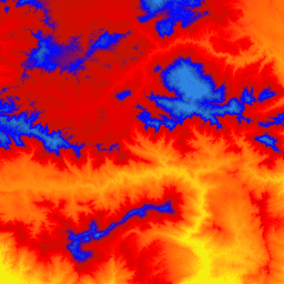
This is a tiled collection of images with 1m pixel size from the 3D Elevation Program (3DEP). The 3DEP data holdings serve as the elevation layer of The National Map and provide foundational elevation information for earth science studies and mapping applications in the United States.
The elevations in this DEM represent the topographic bare-earth surface. USGS standard 1m pixel size DEMs are produced exclusively from high resolution light detection and ranging (lidar) source data of images with 1m pixel size or higher resolution. 1m pixel size DEM surfaces are seamless within collection projects but not necessarily seamless across projects. The spatial reference used for tiles of the 1m pixel size DEM within the conterminous United States (CONUS) is Universal Transverse Mercator (UTM) in units of meters and in conformance with the North American Datum of 1983 (NAD83). All bare earth elevation values are in meters and are referenced to the North American Vertical Datum of 1988 (NAVD88). Each tile is distributed in the UTM Zone in which it lies. If a tile crosses two UTM zones, it is delivered in both zones. In this and other cases of image overlaps, elevation values might be slightly different in different images covering the same area.
The 1m pixel size DEM is the highest resolution standard DEM offered in the 3DEP product suite. The 10m 3DEP dataset is available at USGS_3DEP_10m.
Bands
Bands
| Name | Units | Pixel Size | Description |
|---|---|---|---|
elevation |
m | 1 meter | Elevation (NAVD88) |
Terms of Use
Terms of Use
Most U.S. Geological Survey (USGS) information resides in the public domain and may be used without restriction. Additional information on Acknowledging or Crediting USGS as Information Source is available.
Citations
U.S. Geological Survey, 3D Elevation Program 1-Meter Resolution Digital Elevation Model.
Explore with Earth Engine
Code Editor (JavaScript)
var dataset = ee.ImageCollection('USGS/3DEP/1m');
var visualization = {
  min: 0,
  max: 3000,
  palette: [
    '3ae237', 'b5e22e', 'd6e21f', 'fff705', 'ffd611', 'ffb613', 'ff8b13',
    'ff6e08', 'ff500d', 'ff0000', 'de0101', 'c21301', '0602ff', '235cb1',
    '307ef3', '269db1', '30c8e2', '32d3ef', '3be285', '3ff38f', '86e26f'
  ],
};
Map.setCenter(-119.0, 34.6, 10);
Map.addLayer(dataset, visualization, 'elevation');