Page Summary
-
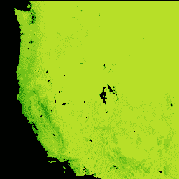
The Landsat Gross Primary Production (GPP) CONUS dataset estimates GPP for CONUS using Landsat Surface Reflectance.
-
This dataset is available from 1986-01-01 to 2021-12-19 and is updated every 16 days.
-
GPP, which is the amount of carbon captured by plants, is calculated using the MOD17 algorithm with Landsat Surface Reflectance, gridMET, and the National Land Cover Database.
-
The dataset includes bands for GPP (16-day gross primary production) and QC (quality of the Landsat NDVI pixel used in the GPP Calculation) at a 30-meter pixel size.
-
This dataset is in the public domain and free of known copyright restrictions, but users should properly cite the source.
- Dataset Availability
- 1986-01-01T00:00:00Z–2021-12-19T00:00:00Z
- Dataset Producer
- University of Montana Numerical Terradynamic Simulation Group (NTSG)
- Cadence
- 16 Days
- Tags
Description
The Landsat Gross Primary Production (GPP) CONUS dataset estimates GPP using Landsat Surface Reflectance for CONUS. GPP is the amount of carbon captured by plants in an ecosystem and is an essential component in the calculations of Net Primary Production (NPP). GPP is calculated using the MOD17 algorithm (see MOD17 User Guide) with Landsat Surface Reflectance, gridMET, and the National Land Cover Database.
Bands
Bands
Pixel size: 30 meters (all bands)
| Name | Units | Min | Max | Scale | Pixel Size | Description |
|---|---|---|---|---|---|---|
GPP |
kg*C/m^2/16-day | 0 | 65535 | 0.0001 | 30 meters | 16-day gross primary production |
QC |
30 meters | Indicates the quality of the Landsat NDVI pixel used in the GPP Calculation |
QC Class Table
| Value | Color | Description |
|---|---|---|
| 10 | #e6194b | Clear not smoothed |
| 11 | #3cb44b | Clear smoothed |
| 20 | #ffe119 | Snow or water not smoothed |
| 21 | #4363d8 | Snow or water smoothed |
| 30 | #f58231 | Climatology not smoothed |
| 31 | #911eb4 | Climatology smoothed |
| 40 | #46f0f0 | Gap filled not smoothed |
| 41 | #f032e6 | Gap filled smoothed |
Terms of Use
Terms of Use
This work is in the public domain and is free of known copyright restrictions. Users should properly cite the source used in the creation of any reports and publications resulting from the use of this dataset and note the date when the data was acquired.
Citations
Robinson, N.P., B.W. Allred, W.K. Smith, M.O. Jones, A. Moreno, T.A. Erickson, D.E. Naugle, and S.W. Running. 2018. Terrestrial primary production for the conterminous United States derived from Landsat 30 m and MODIS 250 m. Remote Sensing in Ecology and Conservation. doi:10.1002/rse2.74
Explore with Earth Engine
Code Editor (JavaScript)
var dataset = ee.ImageCollection('UMT/NTSG/v2/LANDSAT/GPP')
                  .filter(ee.Filter.date('2017-05-01', '2017-05-31'));
var gpp = dataset.select('GPP');
var gppVis = {
  min: 0.0,
  max: 1000.0,
  palette: ['bbe029', '0a9501', '074b03'],
};
Map.setCenter(-98.26, 39.32, 5);
Map.addLayer(gpp, gppVis, 'GPP');