Page Summary
-
The dataset provides global daily-averaged ocean surface and bottom variables at 8km resolution.
-
It includes a 10-day global ocean forecast updated daily, with a two-year sliding time series.
-
The dataset contains bands for various ocean and ice parameters, including temperature, salinity, currents, sea level, and ice properties.
-
Data is available from June 1, 2022, to October 25, 2025.
-
This dataset is released under a Service Level Agreement using the acronym "CMEMS" or "Copernicus Marine Service".
- Dataset Availability
- 2022-06-01T00:00:00Z–2026-03-02T00:00:00Z
- Dataset Producer
- Copernicus Marine Service
- Cadence
- 1 Day
- Tags
Description
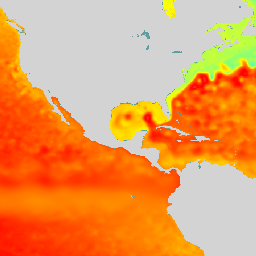
Copernicus Marine Physics 2D Daily Mean Fields (cmems_mod_glo_phy_anfc_0.083deg_P1D-m) deliver global daily-averaged ocean surface and bottom variables at 8km resolution.
The Operational Mercator global ocean analysis and forecast system is providing 10 days of 2D global ocean forecasts updated daily. The time series is aggregated in time in order to reach a two full year's time series sliding window. This product includes daily mean files of temperature, salinity, currents, sea level, mixed layer depth and ice parameters from the top to the bottom over the global ocean.
Bands
Pixel Size
9276.62 meters
Bands
| Name | Units | Pixel Size | Description |
|---|---|---|---|
sialb |
% | meters | Mean albedo over sea ice |
siage |
y | meters | Mean sea ice age |
siconc |
Dimensionless | meters | Sea Ice Concentration |
ist |
°C | meters | Sea Ice Surface Temperature |
sivelo |
m/s | meters | Sea Ice Velocity |
sithick |
m | meters | Sea Ice Thickness |
sisnthick |
m | meters | Sea Ice Surface Snow Thickness |
mlotst |
m | meters | Mixed Layer Depth |
pbo |
Pa | meters | Sea Water Pressure at Sea floor |
sob |
psu | meters | Sea Bottom Salinity |
zos |
m | meters | Sea Surface Height |
tob |
°C | meters | Sea Bottom Temperature |
usi |
m/s | meters | Sea Ice Eastward Velocity |
vsi |
m/s | meters | Sea Ice Northward Velocity |
Image Properties
Image Properties
| Name | Type | Description |
|---|---|---|
| lag_hours | DOUBLE | For observations in the past, the number of hours between the observation and run times. |
| forecast_hours | DOUBLE | For observations in the future, the number of hours between the observation and run times. |
| observation_time | DOUBLE | The valid time of the observation, in milliseconds. |
| observation_type | STRING | Observation type:
|
| run_time | DOUBLE | The time the observation was produced, in milliseconds. |
Terms of Use
Terms of Use
This dataset is released for use under Service Level Agreement (SLA), using the acronym "CMEMS" or the shortened name "Copernicus Marine Service" both denote the E.U. Copernicus Marine Environment Monitoring Service. Highlights and key features of the licence are provided in this document License
Citations
E.U. Copernicus Marine Service Information (2024). Global Ocean Physics Analysis and Forecast. doi:10.48670/moi-00016
Explore with Earth Engine
Code Editor (JavaScript)
var dataset = ee.ImageCollection("COPERNICUS/MARINE/GLOBAL_ANALYSISFORECAST_PHY_DAILY")
                  .filter(ee.Filter.date('2024-07-01', '2024-07-15'));
var elevation = dataset.select('zos');
var elevationVis = {
  min: -2.0,
  max: 1.5,
  palette: ['0000ff', '00ffff', 'ffff00', 'ff0000', 'ffffff'],
};
Map.setCenter(-140.5, 52.2, 2);
Map.addLayer(elevation, elevationVis, 'Sea Surface Height');