MERIT DEM là một DEM toàn cầu có độ chính xác cao với độ phân giải 3 giây cung (~90 m tại đường xích đạo) được tạo ra bằng cách loại bỏ các thành phần lỗi chính khỏi các DEM hiện có (NASA SRTM3 DEM, JAXA AW3D DEM, Viewfinder Panoramas DEM). MERIT DEM separates absolute bias, stripe noise, speckle noise and …
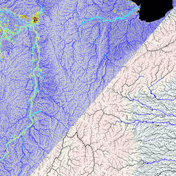
MERIT Hydro là một bản đồ hướng dòng chảy toàn cầu mới có độ phân giải 3 giây cung (~90 m ở đường xích đạo) được lấy từ phiên bản 1.0.3 của dữ liệu độ cao DEM MERIT và các tập dữ liệu về vùng nước (G1WBM, GSWO và OpenStreetMap). MERIT Hydro chứa đầu ra của một …
[[["Dễ hiểu","easyToUnderstand","thumb-up"],["Giúp tôi giải quyết được vấn đề","solvedMyProblem","thumb-up"],["Khác","otherUp","thumb-up"]],[["Thiếu thông tin tôi cần","missingTheInformationINeed","thumb-down"],["Quá phức tạp/quá nhiều bước","tooComplicatedTooManySteps","thumb-down"],["Đã lỗi thời","outOfDate","thumb-down"],["Vấn đề về bản dịch","translationIssue","thumb-down"],["Vấn đề về mẫu/mã","samplesCodeIssue","thumb-down"],["Khác","otherDown","thumb-down"]],[],[],["MERIT DEM is a high-accuracy global Digital Elevation Model (DEM) with a 3 arc-second resolution. It was created by removing errors from existing DEMs. MERIT Hydro, derived from MERIT DEM, is a global flow direction map, also at 3 arc-second resolution, that uses water body datasets. Supplementary visualization layers for MERIT Hydro are also available. The main actions include the creation of these datasets and the enhancement of resolution and correction of errors.\n"]]