- データセットの利用可能な期間
- 2017-03-30T00:00:00Z–2017-03-30T00:00:00Z
- データセット プロデューサー
- 米国国務省地理情報局
- タグ
説明
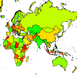
米国地理情報局は、大規模な国際境界(LSIB)データセットを提供しています。詳細版(2013 年)は、LSIB ライン ベクター ファイルと、米国国家地球空間情報局(NGA)の World Vector Shorelines(WVS)という 2 つのデータセットから派生しています。内側の境界線は、境界線、境界線紛争、主権に関する米国政府の政策を反映しています。外側の境界は WVS から取得されますが、WVS の海岸線データは古く、通常は数百メートルから 1 キロメートル以上ずれています。各フィーチャーは、内部境界と外部海岸線(該当する場合)で囲まれたポリゴン領域です。多くの国は、複数のフィーチャー(分離したリージョンごとに 1 つ)で構成されています。
詳細な LSIB と比較して、この簡略化されたデータセットでは、各国の分離したリージョンが 1 つのフィーチャーに縮小されています。また、中規模以下の島は除外されます。簡略化された境界線が、詳細な LSIB 線から 100 メートル以上ずれることはほとんどありません。312 個の各フィーチャーは、このデータセットで説明されている 284 か国のいずれかのジオメトリの一部です。
テーブル スキーマ
テーブル スキーマ
| 名前 | 型 | 説明 |
|---|---|---|
| abbreviati | STRING | 国コード |
| country_co | STRING | |
| country_na | STRING | 米国で認められている国名 |
| wld_rgn | STRING | 大陸地域(南米など) |
利用規約
利用規約
この米国のパブリック ドメイン データには使用制限はありません。
Earth Engine で探索する
コードエディタ(JavaScript)
var dataset = ee.FeatureCollection('USDOS/LSIB_SIMPLE/2017');
var styleParams = {
  fillColor: 'b5ffb4',
  color: '00909F',
  width: 3,
};
var countries = dataset.style(styleParams);
Map.setCenter(16.35, 48.83, 4);
Map.addLayer(countries, {}, 'USDOS/LSIB_SIMPLE/2017', true, 0.8);
FeatureView として可視化する
FeatureView は、FeatureCollection の高速表示専用の表現です。詳細については、
FeatureView のドキュメントをご覧ください。
コードエディタ(JavaScript)
var fvLayer = ui.Map.FeatureViewLayer('USDOS/LSIB_SIMPLE/2017_FeatureView');

var visParams = {
  color: '00909F',
  fillColor: 'b5ffb4',
  width: 3,
  opacity: 1
};

fvLayer.setVisParams(visParams);
fvLayer.setName('USDOS/LSIB_SIMPLE/2017');

Map.setCenter(16.35, 48.83, 4);
Map.add(fvLayer);