- データセットの利用可能な期間
- 2010-01-01T00:00:00Z–2010-01-02T00:00:00Z
- データセット プロデューサー
- 米国国勢調査局
- タグ
説明
米国国勢調査局は、TIGER という名前のジオデータベースを定期的にリリースしています。このデータセットには、2010 年の国勢調査のブロック グループが含まれています。これは、同じ国勢調査区内のブロックのクラスタで、4 桁の国勢調査ブロック番号の最初の数字が同じです。米国、コロンビア特別区、プエルトリコ、および離島地域をカバーするポリゴン フィーチャーは 30 万件強あります。
すべての TIGER 2010 プロダクトの技術的な詳細については、TIGER の技術ドキュメントをご覧ください。
テーブル スキーマ
テーブル スキーマ
| 名前 | 型 | 説明 |
|---|---|---|
| ALAND10 | DOUBLE | 土地面積(平方メートル) |
| AWATER10 | DOUBLE | 水域面積(平方メートル) |
| BLKGRPCE10 | STRING | ブロック グループ コード |
| COUNTYFP10 | STRING | 郡の FIPS コード |
| FUNCSTAT10 | STRING | 機能ステータス(S = 統計) |
| GEOID10 | STRING | 要約レベル、特性の反復、米国、州、郡、区画、ブロック グループ コードの一意の識別子 |
| INTPTLAT10 | DOUBLE | 内部ポイントの緯度 |
| INTPTLON10 | DOUBLE | 内部ポイントの経度 |
| MTFCC10 | STRING | MAF/TIGER のフィーチャー分類コード |
| NAMELSAD10 | STRING | 氏名 |
| STATEFP10 | STRING | 州の FIPS コード |
| TRACTCE10 | STRING | 国勢調査区コード |
利用規約
利用規約
米国国勢調査局は、一部の公開データをアプリケーション プログラミング インターフェース(API)を介して機械可読形式で提供しています。API を通じて提供されるすべてのコンテンツ、ドキュメント、コード、関連資料には、これらの利用規約が適用されます。
引用
引用:
データセットから作成されたレポート、出版物、新しいデータセット、派生商品、サービスについては、米国国勢調査局を引用する必要があります。
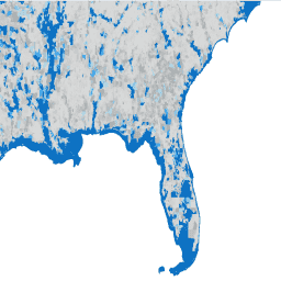
Earth Engine で探索する
コードエディタ(JavaScript)
var dataset = ee.FeatureCollection('TIGER/2010/BG');

var visParams = {
  min: 0,
  max: 1e7,
  palette: ['d8d9d9', 'aaaaaa', 'b6dfe9', '2ea3f2', '0c71c3']
};

// plotting the water area per polygon
dataset = dataset.map(function (f) {
  return f.set('AWATER10', ee.Number.parse(f.get('AWATER10')));
});

var image = ee.Image().float().paint(dataset, 'AWATER10');

Map.setCenter(-81.99172, 29.74101, 9);
Map.addLayer(ee.Image(1), {min: 0, max: 1}, 'background');
Map.addLayer(image, visParams, 'TIGER/2010/BG');
Map.addLayer(dataset, null, 'for Inspector', false);