-
Oil Palm Plantation Probability v20240312

This image collection provides per-pixel probability that the underlying area is in oil palm cultivation. These probability estimates are provided at 10 meter resolution, and have been generated by a machine learning model. Labeled examples of oil palm plantations were supplied by community contributors to … biodiversity conservation crop deforestation eudr landuse -
National Intertidal Digital Elevation Model 25m 1.0.0

The National Intertidal Digital Elevation Model (NIDEM; Bishop-Taylor et al. 2018, 2019) is a continental-scale elevation dataset for Australia's exposed intertidal zone. NIDEM provides the first three-dimensional representation of Australia's intertidal sandy beaches and shores, tidal flats and rocky shores and reefs at 25 m … australia dem ga geoscience-aus-cat landsat-derived publisher-dataset -
DEA Geometric Median and Median Absolute Deviation - Landsat 5 3.1.0

This product provides statistical tools to exploit the time series of Landsat 5 data available in Digital Earth Australia, providing annual images of general conditions and how much an area changes for a given year. The geomedian part of the product provides an "average" cloud-free … australia ga geoscience-aus-cat landsat-derived publisher-dataset -
DEA Geometric Median and Median Absolute Deviation - Landsat 7 3.1.0

This product provides statistical tools to exploit the time series of Landsat 7 data available in Digital Earth Australia, providing annual images of general conditions and how much an area changes for a given year. The geomedian part of the product provides an "average" cloud-free … australia ga geoscience-aus-cat landsat-derived publisher-dataset -
DEA Geometric Median and Median Absolute Deviation - Landsat 8 3.1.0

This product provides statistical tools to exploit the time series of Landsat 8 data available in Digital Earth Australia, providing annual images of general conditions and how much an area changes for a given year. The geomedian part of the product provides an "average" cloud-free … australia ga geoscience-aus-cat landsat-derived publisher-dataset -
DEA Land Cover 1.0.0

Digital Earth Australia (DEA) Land Cover provides annual land cover classifications for Australia using the Food and Agriculture Organisation Land Cover Classification System taxonomy Version 2 (Di Gregorio and Jansen, 1998; 2005). DEA Land Cover translates over 30 years of satellite imagery into evidence of … australia ga geoscience-aus-cat landcover landsat-derived publisher-dataset -
DEA Water Observations Statistics 3.1.6

Digital Earth Australia (DEA) Water Observations uses an algorithm to classify each pixel from Landsat satellite imagery as 'wet', 'dry', or 'invalid'. Water Observations Statistics provides information on how many times each year the Landsat satellites were able to clearly see an area, how many … australia ga geoscience-aus-cat landsat-derived publisher-dataset water -
NEON Canopy Height Model (CHM)
Height of the top of canopy above bare earth (Canopy Height Model; CHM). The CHM is derived from the Lidar point cloud, and is generated by creating a continuous surface of canopy height estimates across the entire spatial domain of the Lidar survey. The point … canopy forest lidar publisher-dataset vegetation -
NICFI Satellite Data Program Basemaps for Tropical Forest Monitoring - Africa
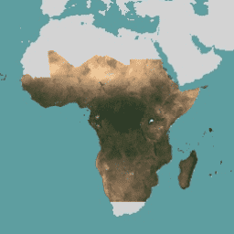
This image collection provides access to high-resolution satellite monitoring of the tropics for the primary purpose of reducing and reversing the loss of tropical forests, contributing to combating climate change, conserving biodiversity, contributing to forest regrowth, restoration and enhancement, and facilitating sustainable development, all of … basemaps forest nicfi planet planet-nicfi publisher-dataset -
NICFI Satellite Data Program Basemaps for Tropical Forest Monitoring - Americas
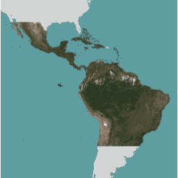
This image collection provides access to high-resolution satellite monitoring of the tropics for the primary purpose of reducing and reversing the loss of tropical forests, contributing to combating climate change, conserving biodiversity, contributing to forest regrowth, restoration and enhancement, and facilitating sustainable development, all of … basemaps forest nicfi planet planet-nicfi publisher-dataset -
NICFI Satellite Data Program Basemaps for Tropical Forest Monitoring - Asia
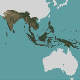
This image collection provides access to high-resolution satellite monitoring of the tropics for the primary purpose of reducing and reversing the loss of tropical forests, contributing to combating climate change, conserving biodiversity, contributing to forest regrowth, restoration and enhancement, and facilitating sustainable development, all of … basemaps forest nicfi planet planet-nicfi publisher-dataset
[{
"type": "thumb-down",
"id": "missingTheInformationINeed",
"label":"Missing the information I need"
},{
"type": "thumb-down",
"id": "tooComplicatedTooManySteps",
"label":"Too complicated / too many steps"
},{
"type": "thumb-down",
"id": "outOfDate",
"label":"Out of date"
},{
"type": "thumb-down",
"id": "samplesCodeIssue",
"label":"Samples / code issue"
},{
"type": "thumb-down",
"id": "otherDown",
"label":"Other"
}]
[{
"type": "thumb-up",
"id": "easyToUnderstand",
"label":"Easy to understand"
},{
"type": "thumb-up",
"id": "solvedMyProblem",
"label":"Solved my problem"
},{
"type": "thumb-up",
"id": "otherUp",
"label":"Other"
}]