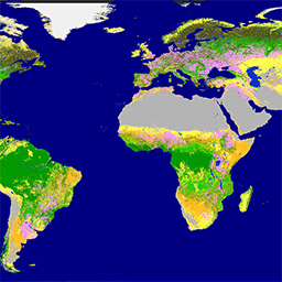
[[["わかりやすい","easyToUnderstand","thumb-up"],["問題の解決に役立った","solvedMyProblem","thumb-up"],["その他","otherUp","thumb-up"]],[["必要な情報がない","missingTheInformationINeed","thumb-down"],["複雑すぎる / 手順が多すぎる","tooComplicatedTooManySteps","thumb-down"],["最新ではない","outOfDate","thumb-down"],["翻訳に関する問題","translationIssue","thumb-down"],["サンプル / コードに問題がある","samplesCodeIssue","thumb-down"],["その他","otherDown","thumb-down"]],[],[[["\u003cp\u003eThe Copernicus Global Land Service provides bio-geophysical products on the status and evolution of land surface at a global scale, including a dynamic land cover map.\u003c/p\u003e\n"],["\u003cp\u003eThe Proba-V satellite mission maps land cover and vegetation growth, providing continuity for the SPOT missions' VGT instrument.\u003c/p\u003e\n"],["\u003cp\u003eProba-V collects data in three visible and near-infrared (VNIR) bands and one short-wave infrared (SWIR) band, offering daily top-of-canopy synthesis at both 100m and 333m resolutions.\u003c/p\u003e\n"]]],[],null,[]]