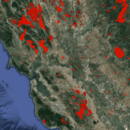
ขอบเขตไฟตามชุดข้อมูล MODIS MCD64A1 ข้อมูลนี้คำนวณจากอัลกอริทึมที่อาศัยการเข้ารหัสความสัมพันธ์เชิงพื้นที่และเวลาในโครงสร้างกราฟระหว่างแพตช์ของพื้นที่ที่ถูกไฟไหม้ ไฟแต่ละครั้งจะมีหมายเลขที่ไม่ซ้ำกันซึ่งระบุเหตุการณ์
ขอบเขตไฟตามชุดข้อมูล MODIS MCD64A1 ข้อมูลนี้คำนวณจากอัลกอริทึมที่อาศัยการเข้ารหัสความสัมพันธ์เชิงพื้นที่และเวลาในโครงสร้างกราฟระหว่างแพตช์ของพื้นที่ที่ถูกไฟไหม้ ไฟแต่ละครั้งจะมีหมายเลขที่ไม่ซ้ำกันซึ่งระบุเหตุการณ์
[[["เข้าใจง่าย","easyToUnderstand","thumb-up"],["แก้ปัญหาของฉันได้","solvedMyProblem","thumb-up"],["อื่นๆ","otherUp","thumb-up"]],[["ไม่มีข้อมูลที่ฉันต้องการ","missingTheInformationINeed","thumb-down"],["ซับซ้อนเกินไป/มีหลายขั้นตอนมากเกินไป","tooComplicatedTooManySteps","thumb-down"],["ล้าสมัย","outOfDate","thumb-down"],["ปัญหาเกี่ยวกับการแปล","translationIssue","thumb-down"],["ตัวอย่าง/ปัญหาเกี่ยวกับโค้ด","samplesCodeIssue","thumb-down"],["อื่นๆ","otherDown","thumb-down"]],[],[],["The content describes three datasets related to fire and burned areas, all utilizing the MODIS MCD64A1 dataset. Two datasets, \"GlobFire Daily\" and \"GlobFire Final,\" provide fire boundaries, computed by an algorithm using the space-time relationships between burned patches, each with a unique identifier. The third dataset, \"MCD64A1.061,\" is a monthly global product with 500m resolution, detailing burned areas and quality using surface reflectance imagery and active fire observations.\n"]]