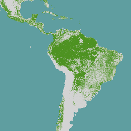
The global map of forest cover provides a spatially explicit representation of forest presence and absence for the year 2020 at 10m spatial resolution. The year 2020 corresponds to the cut-off date of the Regulation from the European Union "on the making available on the …
The global map of forest types provides a spatially explicit representation of primary forest, naturally regenerating forest and planted forest (including plantation forest) for the year 2020 at 10m spatial resolution. The base layer for mapping these forest types is the extent of forest cover …
Note: This dataset is not yet peer-reviewed. Please see the GitHub README associated with this model for more information. This image collection provides per-pixel probability that the underlying area is occupied by cocoa. The probability estimates are provided at 10 meter resolution, and have been …
Note: This dataset is not yet peer-reviewed. Please see the GitHub README associated with this model for more information. This image provides a per-pixel score (in [0, 1]) that indicates whether the pixel area is occupied by undisturbed forest in year 2020. These scores are …
Note: This dataset is not yet peer-reviewed. Please see the GitHub README associated with this model for more information. This image collection provides per-pixel probability that the underlying area is occupied by palm. The probability estimates are provided at 10 meter resolution, and have been …
Note: This dataset is not yet peer-reviewed. Please see the GitHub README associated with this model for more information. This image collection provides per-pixel probability that the underlying area is occupied by rubber trees. The probability estimates are provided at 10 meter resolution, and have …
[[["Easy to understand","easyToUnderstand","thumb-up"],["Solved my problem","solvedMyProblem","thumb-up"],["Other","otherUp","thumb-up"]],[["Missing the information I need","missingTheInformationINeed","thumb-down"],["Too complicated / too many steps","tooComplicatedTooManySteps","thumb-down"],["Out of date","outOfDate","thumb-down"],["Samples / code issue","samplesCodeIssue","thumb-down"],["Other","otherDown","thumb-down"]],[],[[["The datasets provide information on global forest cover, including forest presence, absence, and types, at 10m resolution for the year 2020."],["There are probability models for cocoa, palm, and rubber tree occupation, offering per-pixel likelihood estimates at 10m resolution."],["A Forest Persistence dataset provides scores indicating undisturbed forest areas in 2020, aiding in deforestation analysis."],["Many of the datasets are associated with the Forest Data Partnership and some are pre-review, requiring caution in interpretation and application."],["Datasets support various applications like biodiversity conservation, land use planning, and compliance with EU deforestation regulations."]]],[]]