- データセットの利用可能な期間
- 2002-06-15T00:00:00Z–2023-11-17T00:00:00Z
- データセット プロデューサー
- 米国農務省の農場生産と保全 - ビジネス センター、地理空間エンタープライズ オペレーション
- タグ
説明
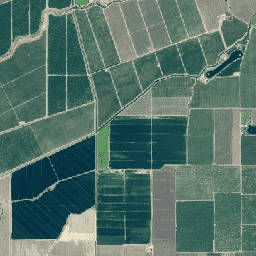
National Agriculture Imagery Program(NAIP)は、米国本土の農業の成長期に航空写真を取得します。
NAIP プロジェクトは、利用可能な資金と画像取得サイクルに基づいて毎年契約されます。2003 年以降、NAIP は 5 年周期で取得されました。2008 年は移行期であり、2009 年から 3 年間のサイクルが始まりました。
NAIP 画像は、1 メートルの地上サンプル距離(GSD)で取得され、画像検査で使用される写真で識別可能な地上コントロール ポイントの 6 メートル以内の水平精度で取得されます。
古い画像は 3 つのバンド(赤、緑、青: RGB)を使用して収集されましたが、新しい画像は通常、追加の近赤外線バンド(RGBN)を使用して収集されます。RGB アセット ID は「n」で始まり、NRG アセット ID は「c」で始まり、RGBN アセット ID は「m_」で始まります。
一部の古い画像では、GSD が 2 メートルです。
バンド
ピクセルサイズ
0.6 メートル
バンド
| 名前 | 単位 | ピクセルサイズ | 説明 |
|---|---|---|---|
R |
dn | メートル | 赤 |
G |
dn | メートル | 緑 |
B |
dn | メートル | 青 |
N |
dn | メートル | 近赤外線 |
利用規約
利用規約
FSA のウェブサイトに掲載されている情報のほとんどは、パブリック ドメイン情報と見なされます。パブリック ドメインの情報は自由に配布またはコピーできますが、適切な署名、写真、画像のクレジットを使用することが求められます。詳しくは、FSA のポリシーとリンクのウェブサイトをご覧ください。
このデータセットを使用または配布する際は、USDA Farm Production and Conservation - Business Center, Geospatial Enterprise Operations を明記する必要があります。
引用
米国農務省の農業生産と保全 - ビジネス センター、地理空間エンタープライズ オペレーション
Earth Engine で探索する
コードエディタ(JavaScript)
var dataset = ee.ImageCollection('USDA/NAIP/DOQQ')
                  .filter(ee.Filter.date('2017-01-01', '2018-12-31'));
var trueColor = dataset.select(['R', 'G', 'B']);
var trueColorVis = {
  min: 0,
  max: 255,
};
Map.setCenter(-73.9958, 40.7278, 15);
Map.addLayer(trueColor, trueColorVis, 'True Color');