- データセットの利用可能な期間
- 1979-01-01T00:00:00Z–2026-02-21T00:00:00Z
- データセット プロデューサー
- NOAA Physical Sciences Laboratory
- タグ
説明
このデータセットは、世界中の陸地における毎日の地表気温のグリッド分析を提供します。これには、毎日の最高気温(Tmax)と最低気温(Tmin)が含まれます。1979 年から現在までのデータが、CPC のゲージベースのグローバルな日次降水量の分析の解像度に合わせて、0.5 度の緯度/経度グリッドで表示されます。このデータセットの構築では、地形効果が考慮されています。主な目的は、気候モニタリングと予測検証アクティビティをサポートすることです。入力データは、GTS(Global Telecommunication System)の日次レポートの CPC アーカイブから取得され、約 6,000 ~ 7,000 のグローバル ステーションの Tmax データと Tmin データが組み込まれています。
技術ドキュメントについては、こちらをご覧ください。
バンド
ピクセルサイズ
55,500 メートル
バンド
| 名前 | 単位 | 最小 | 最大 | ピクセルサイズ | 説明 |
|---|---|---|---|---|---|
tmax |
°C | -89.84* | 66.03* | メートル | 日最高気温 |
tmin |
°C | -97.92* | 54.26* | メートル | 日最低気温 |
nmax |
0* | 7* | メートル | 最高気温のレポート数 |
|
nmin |
0* | 7* | メートル | 最低温度のレポート数 |
利用規約
利用規約
NOAA CPC データセットは、使用や配布に制限なく利用できます。NOAA PSL は、該当する場合、ユーザーが適切な帰属表示を行い、NOAA PSL をデータのソースとして特定することを求めています。
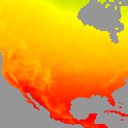
Earth Engine で探索する
コードエディタ(JavaScript)
var dataset = ee.ImageCollection('NOAA/CPC/Temperature').filter(ee.Filter.date('2018-01-01', '2019-01-01'));
var temperature = dataset.select('tmax');
var temperatureVis = {
  min: -40,
  max: 50,
  palette: ['#ADD8E6', '#008000', '#FFFF00', '#FFA500', '#FF0000', '#800080'],
};
Map.setCenter(-104.8, 49.1, 3);
Map.addLayer(temperature, temperatureVis, 'NOAA CPC Temperature');