- データセットの利用可能な期間
- 2000-02-24T00:00:00Z–2026-01-01T00:00:00Z
- データセット プロデューサー
- USGS EROS センターの NASA LP DAAC
- ケイデンス
- 1 日
- タグ
説明
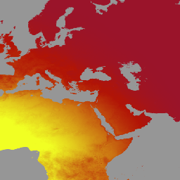
MCD18C2 バージョン 6.2 は、中解像度画像分光放射計(MODIS)Terra と Aqua を組み合わせた光合成有効放射(PAR)グリッド化レベル 3 プロダクトで、毎日 0.05 度(赤道で 5,600 メートル)の解像度で生成され、3 時間ごとに PAR の推定値が提供されます。PAR は、可視スペクトル(400 ~ 700 ナノメートル)の入射太陽放射であり、さまざまな科学的およびアプリケーションの問題に対処する陸地表面モデルの重要な変数です。MCD18 プロダクトは、MODIS データの多時相シグネチャを使用して地表反射率を導出し、ルックアップ テーブル(LUT)アプローチを使用して入射 PAR を計算するプロトタイピング アルゴリズムに基づいています。LUT は、さまざまな照明/視認ジオメトリにおけるエアロゾルと雲のさまざまな種類の負荷を考慮します。グローバル PAR プロダクトは、MODIS と静止衛星データから生成されます。データの作成に使用された方法論に関する詳細については、アルゴリズムの理論的根拠に関するドキュメントをご覧ください。
バンド
ピクセルサイズ
500 メートル
バンド
| 名前 | ピクセルサイズ | 説明 |
|---|---|---|
GMT_0000_PAR |
メートル | GMT 00:00 の合計 PAR |
GMT_0300_PAR |
メートル | GMT 03:00 の合計 PAR |
GMT_0600_PAR |
メートル | GMT 06:00 の合計 PAR |
GMT_0900_PAR |
メートル | GMT 09:00 の合計 PAR |
GMT_1200_PAR |
メートル | GMT 12:00 の合計 PAR |
GMT_1500_PAR |
メートル | GMT 15:00 の合計 PAR |
GMT_1800_PAR |
メートル | GMT 18:00 の合計 PAR |
GMT_2100_PAR |
メートル | GMT 21:00 の合計 PAR |
利用規約
利用規約
LP DAAC を通じて取得した MODIS データとプロダクトには、その後の使用、販売、再配布に関する制限はありません。
引用
LP DAAC データセットの引用については、LP DAAC の「Citing Our Data」ページを参照してください。
DOI
Earth Engine で探索する
コードエディタ(JavaScript)
var dataset = ee.ImageCollection('MODIS/062/MCD18C2')
                  .filter(ee.Filter.date('2001-01-01', '2001-02-01'));
var gmt_1200_par = dataset.select('GMT_1200_PAR');
var gmt_1200_par_vis = {
  min: -236,
  max: 316,
  palette: ['0f17ff', 'b11406', 'f1ff23'],
};
Map.setCenter(6.746, 46.529, 2);
Map.addLayer(
    gmt_1200_par, gmt_1200_par_vis,
    'Total PAR at GMT 12:00');