- データセットの利用可能な期間
- 2009-01-01T00:00:00Z–2023-03-11T00:00:00Z
- データセット プロデューサー
- FAO UN
- ケイデンス
- 10 日間
- タグ
説明
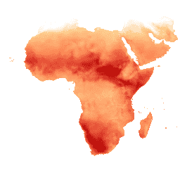
基準蒸発散量(RET)は、仮想の基準作物の蒸発散量として定義され、十分に灌漑された草地の表面の挙動をシミュレートします。各ピクセルの値は、その特定の旬の 1 日あたりの基準蒸発散量の平均値を表します。
バンド
ピクセルサイズ
18,924 メートル
バンド
| 名前 | 単位 | スケール | ピクセルサイズ | 説明 |
|---|---|---|---|---|
L1_RET_D |
mm | 0.1 | メートル | 基準蒸発散量(10 日間)[mm] |
利用規約
利用規約
国連食糧農業機関(FAO)は、栄養、食料、農業に関する情報を収集、分析、解釈、普及する権限を与えられています。この点に関して、FAO は FAO の権限に関連するトピックに関する多数のデータベースを公開し、科学的および研究目的での使用を推奨しています。統計データベースのオープンデータ ライセンスで想定されているオープン性と共有の原則に沿って、また FAO の使命に沿って、水生産性オープン アクセス ポータル(WaPOR)のデータ(AQUASTAT - 水と農業に関する FAO のグローバル情報システムの一部)は、ユーザー コミュニティに無料で提供されています。
引用
引用:
FAO 2018。WaPOR データベースの方法論: レベル 1。Remote Sensing for Water Productivity Technical Report: Methodology Series. ローマ、FAO。72 ページ。
FAO 2020。WaPOR V2 データベースの手法。Remote Sensing for Water Productivity Technical Report: Methodology Series(水生産性に関するリモート センシング技術レポート: 方法論シリーズ)。Rome, FAO.https://www.fao.org/3/ca9894en/CA9894EN.pdf
Earth Engine で探索する
コードエディタ(JavaScript)
var coll = ee.ImageCollection('FAO/WAPOR/2/L1_RET_D');
var image = coll.first();
Map.setCenter(17.5, 20, 3);
Map.addLayer(image, {min: 0, max: 100});