- Dataset Availability
- 2000-02-11T00:00:00Z–2000-02-22T00:00:00Z
- Dataset Provider
- WWF
- Earth Engine Snippet
-
ee.Image("WWF/HydroSHEDS/03VFDEM") - Tags
Description
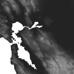
HydroSHEDS is a mapping product that provides hydrographic information for regional and global-scale applications in a consistent format. It offers a suite of geo-referenced datasets (vector and raster) at various scales, including river networks, watershed boundaries, drainage directions, and flow accumulations. HydroSHEDS is based on elevation data obtained in 2000 by NASA's Shuttle Radar Topography Mission (SRTM).
This void-filled elevation dataset is the first step towards producing the conditioned DEM datasets. Spikes and wells in the SRTM data were detected and voided out. Small voids were filled by interpolation of surrounding elevations. The ocean was set to an elevation of 0 meters, and lakes, islands, and rivers were filled using other techniques. Full details of the underlying digital elevation model are available in the HydroSHEDS website and documentation.
This dataset is at 3 arc-second resolution. The datasets available at 3 arc-seconds are the Void-Filled DEM, Hydrologically Conditioned DEM, and Drainage (Flow) Direction.
Note that the quality of the HydroSHEDS data is significantly lower for regions above 60 degrees northern latitude as there is no underlying SRTM elevation data available and thus a coarser-resolution DEM was (HYDRO1k provided by USGS).
HydroSHEDS was developed by the World Wildlife Fund (WWF) Conservation Science Program in partnership with the U.S. Geological Survey, the International Centre for Tropical Agriculture, The Nature Conservancy, and the Center for Environmental Systems Research of the University of Kassel, Germany.
Bands
Resolution
92.77 meters
Bands
| Name | Units | Min | Max | Description |
|---|---|---|---|---|
b1 |
m | -424* | 8642* | Elevation |
Terms of Use
Terms of Use
HydroSHEDS data are free for non-commercial and commercial use. For more information, please refer to the License Agreement.
Citations
Lehner, B., Verdin, K., Jarvis, A. (2008): New global hydrography derived from spaceborne elevation data. Eos, Transactions, AGU, 89(10): 93-94.
Explore with Earth Engine
Code Editor (JavaScript)
var dataset = ee.Image('WWF/HydroSHEDS/03VFDEM');
var elevation = dataset.select('b1');
var elevationVis = {
  min: -50.0,
  max: 3000.0,
  gamma: 2.0,
};
Map.setCenter(-121.652, 38.022, 8);
Map.addLayer(elevation, elevationVis, 'Elevation');